
The first recorded aerial photograph captured by a plane was in 1908 in France. The initial usage of aerial photography ranged from applications of war & spying to land surveying & photogrammetry.
South Africa began engaging in aerial photography as early as 1918. A handful of aerial photographs of the Riebeek Valley were captured around the mid-1900s, giving a glimpse into the recent past before significant residential development and the scaling & heavy industrialization of farming had taken place.
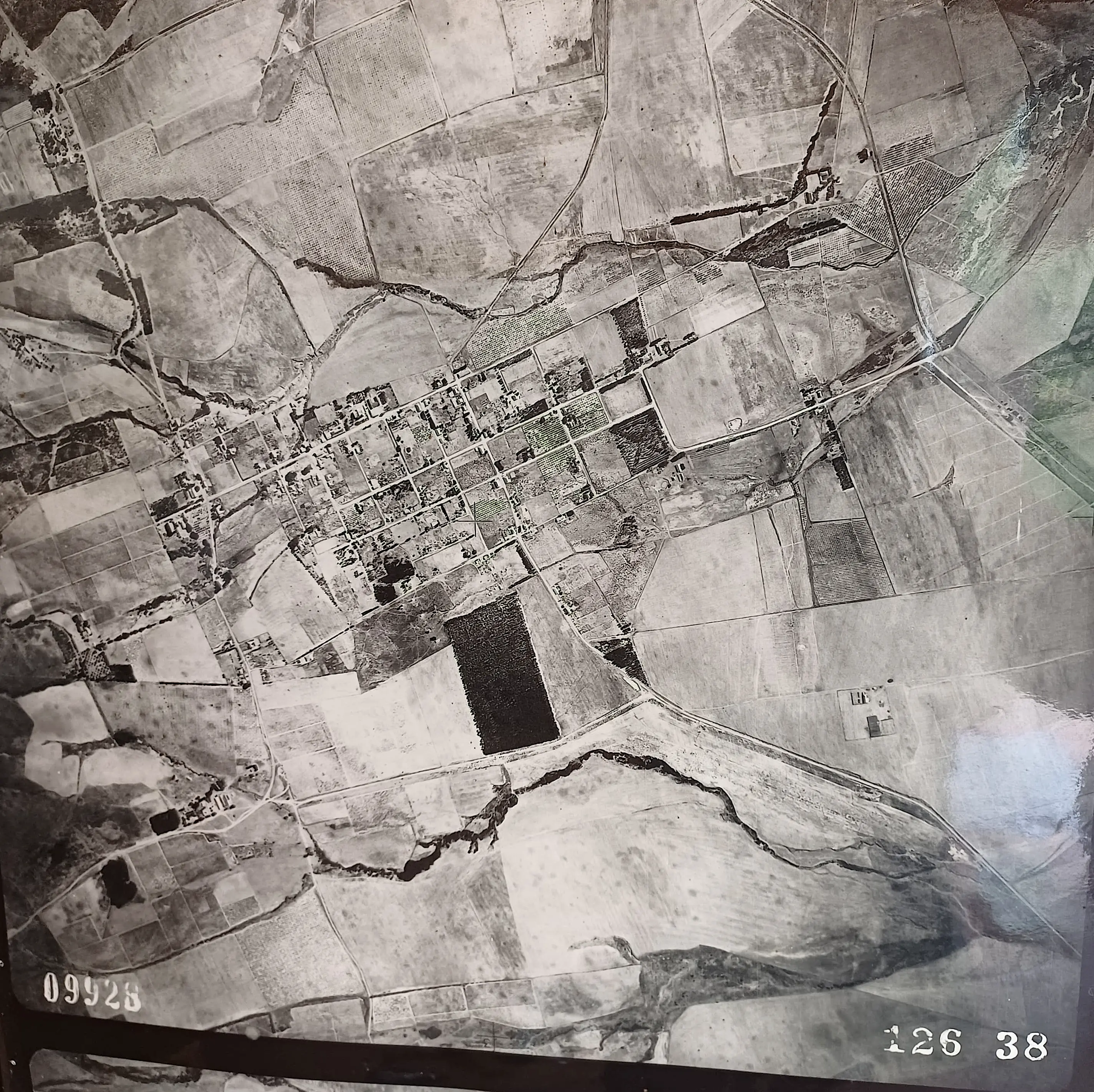
1938 Riebeek Kasteel
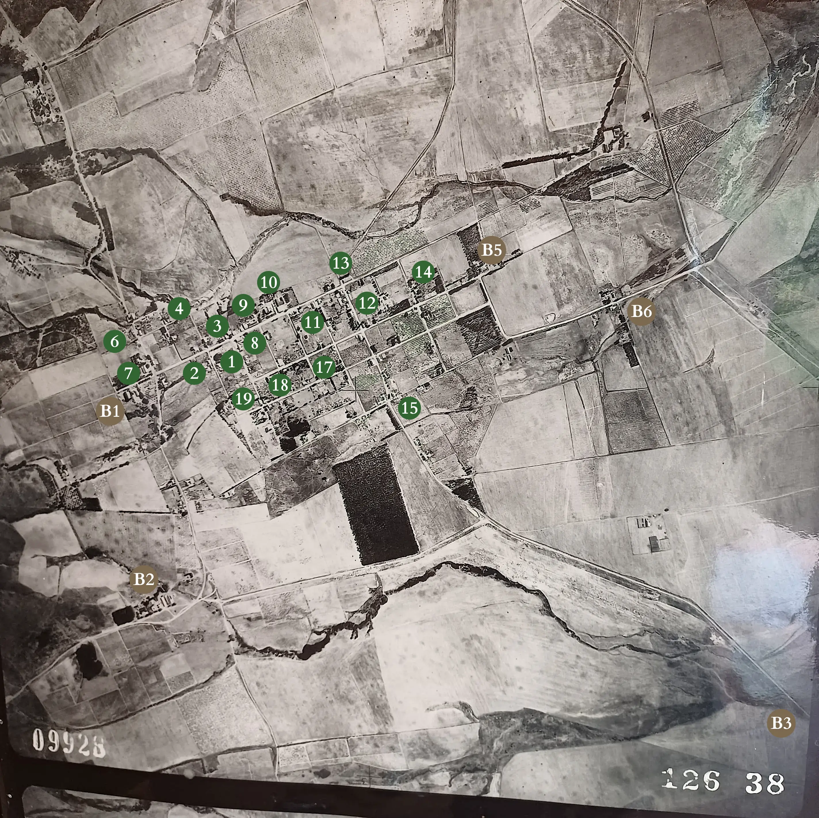
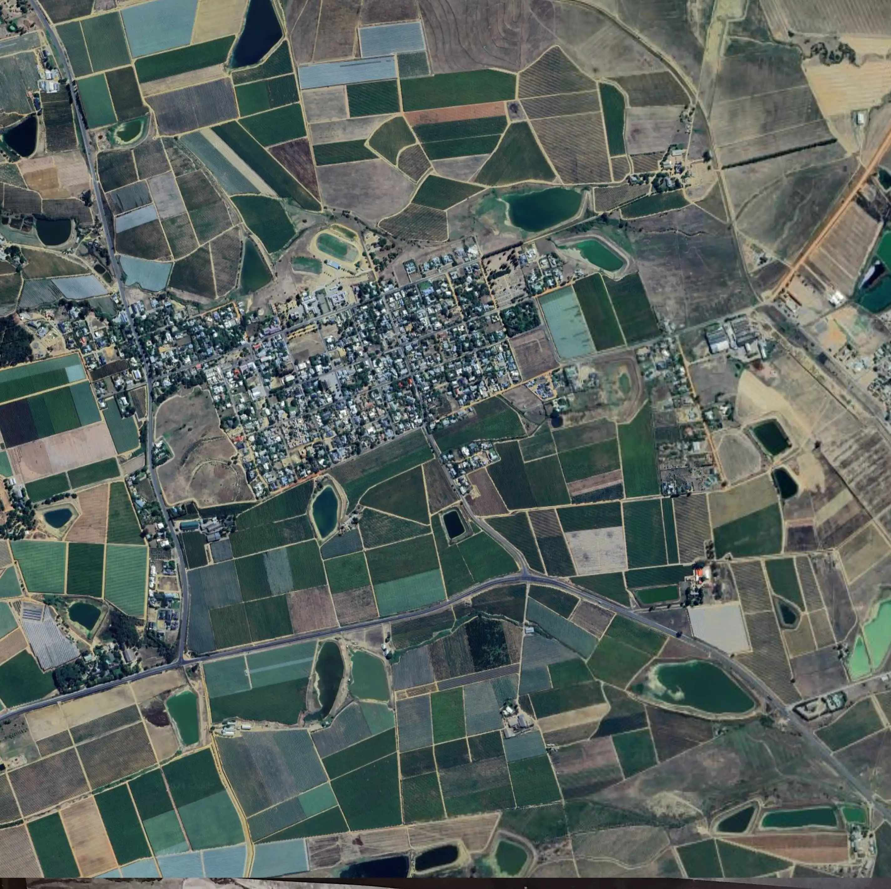
A magnificent vertical aerial photograph was captured in 1938, featuring the village of Riebeek Kasteel and its general surroundings.
Use the controls below to overlay landmark names, Riebeek Kasteel Heritage Walk destinations, or the modern 2024 view on the old aerial photograph.


Oblique Aerial Photographs
A couple of aerial photographs were captured of Riebeek Kasteel in the early 1900s at an angle from a low-flying plane.
The photograph below, captured at an unknown date evidently before the 1929 renovation of the Royal Hotel, features what is now the commercial centre of Riebeek Kasteel.
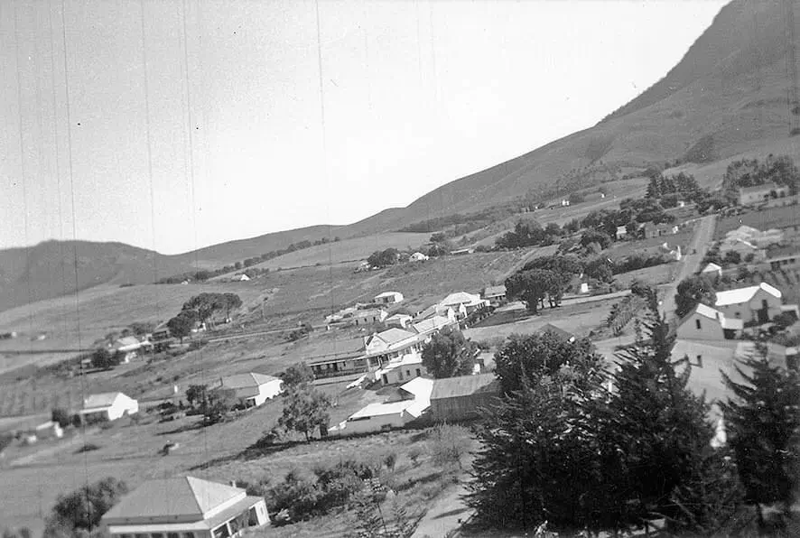
Centrally placed is the municipal building, which at the time was Basson’s General Store. Various commercial buildings can be seen in their original state, as well as the vastness between the heritage buildings scattered throughout this part of the village.
The second archived oblique aerial photograph consists of a pair of photographs comparing the same area of Booysen & Church Street in Riebeek Kasteel. The photograph at the top is said to have been captured around 1920, while the bottom is from 1948.
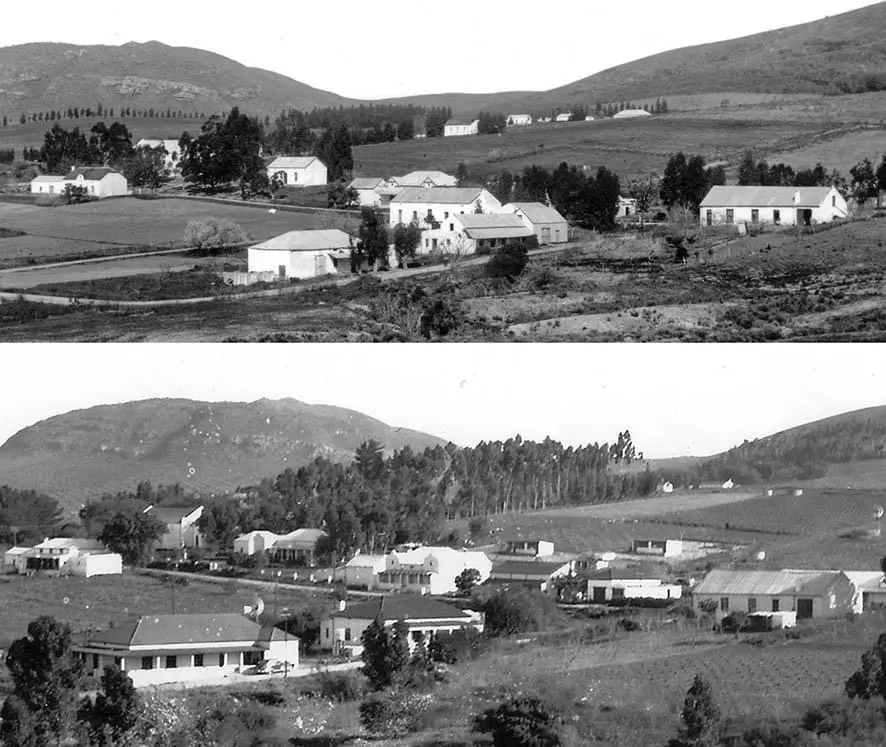
There are a number of interesting observations when comparing these two photographs. At the lower end of both photos are the two heritage buildings on Booysen Street – both of which were transformed over this period. The lower house originally appears to have been a barn with a kraal alongside, which was subsequently transformed into a home. The adjacent house above, likely its homestead, had its gable roof transformed into a hip roof along with other alterations. Directly above is a substantial heritage property that was completely demolished and lost over this period.
On Church Street, starting from the right (north) is what appears to be Remhoogte’s wagon house. Centrally is what is now Oak Manor and the Smit’s house with the dual gable frontage next door. One can notice how the gable facade and renovations of Oak Manor weren’t fully completed by 1948 and that the now-famous Oak Tree isn’t particularly visible yet. The Smit’s house next door had its dual Victorian gables transformed into Cape Dutch style gables over this period, likely as an aesthetic statement of grandeur and to fit in with the architectural trends.
On the left (south), De Oude Kerk can be seen amidst the line of trees, which had grown substantially over a 30 year period. Visible in the older photograph and across Church Street from De Oude Kerk is a cute vernacular heritage building with a central gable and roof clad in thatch, as well as its outbuilding alongside. By 1948, this building had been transformed and it unfortunately no longer appears to exist today.
